Our Products
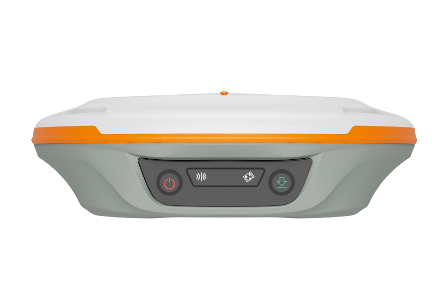
- 1590 channels; 50+ satellites
- GPS, BDS-2/3, GLONASS, Galileo, QZSS, IRNSS, SBAS
- UHF up to 15 km • Tilt 120° (≈2.5 cm)
- 20+ hrs • 10,000 mAh • IP67
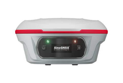
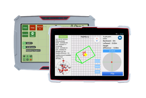
- Laser + dual camera stakeout
- 1668 channels • all constellations
- Auto‑IMU tilt 120° • OLED status
- Super datalink up to 15 km
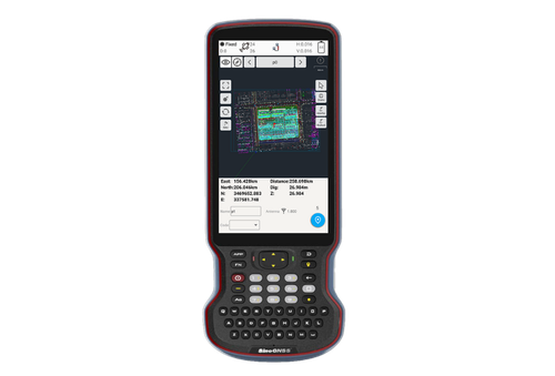
- Android 12 • 5.5″ FHD display
- Physical QWERTY keyboard
- 9000 mAh • 4G/Wi‑Fi/BT/NFC
- IP67 rugged
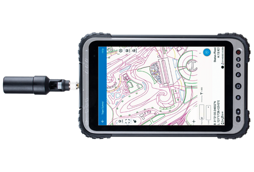
8″ sunlight‑readable • Android 12 (GMS) • Integrated GNSS • 4G/Wi‑Fi/BT 5.1 • IP67.
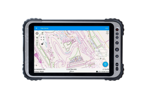
8″ sunlight‑readable • Android 12 (GMS) • Optional high‑precision GNSS • 4G/Wi‑Fi/BT 5.1 • IP67.
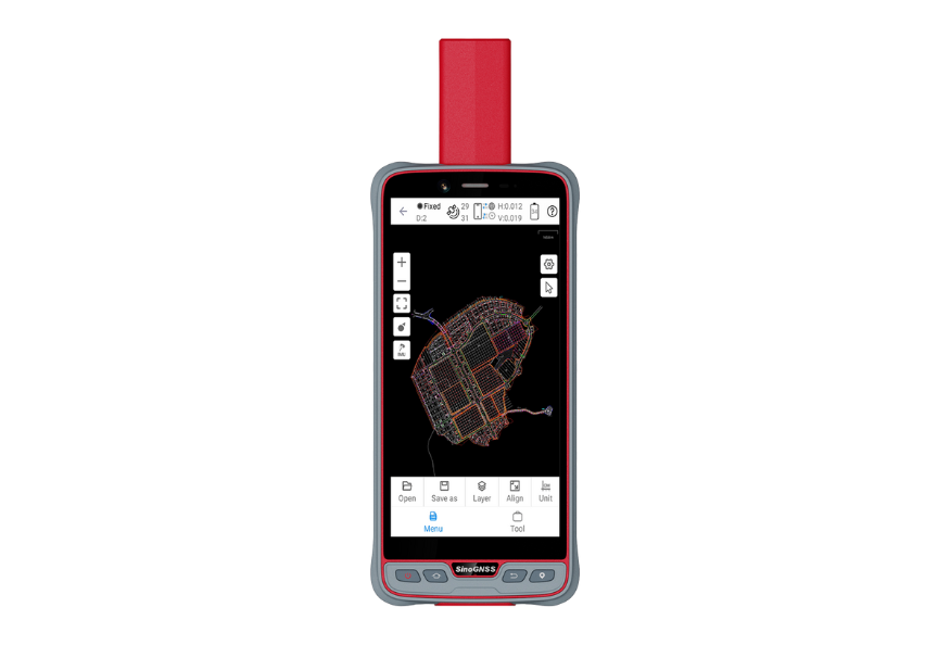
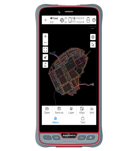
6″ sunlight‑readable • Android 11 (GMS) • SinoGNSS K8 • RTK‑cm/PPP‑dm • 4G/Wi‑Fi/BT 5.0 • IP67.
6″ sunlight‑readable HD • Android 11 (GMS) • 4G/Wi‑Fi/BT 5.0 • IP67 • 1.2 m drop.
- Built‑in pro GNSS • full constellations
- QUANTUM™ III enhanced heading
- 8″ / 10.1″ HD touchscreen • Android
- 4G LTE • Wi‑Fi • BT 5.0 • Cameras
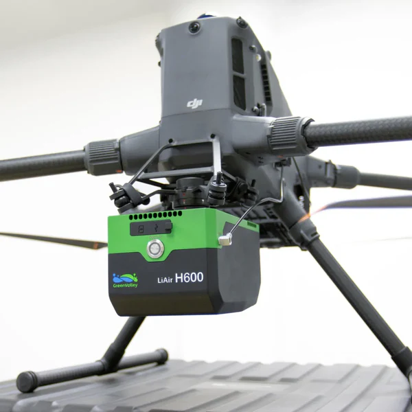
Medium-range LiDAR • 1.3 kg • 750 m range • 550 kHz scan • ±5 cm accuracy • 26 MP camera • IP64 • DJI compatible.
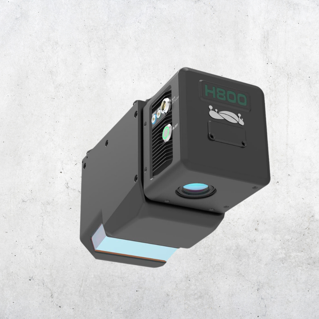
Medium-to-long-range LiDAR • 2.25 kg • up to 1000 m range • ±5 cm vertical accuracy • 100–2000 kHz scan • 26 MP camera • GNSS/IMU • Wi-Fi.
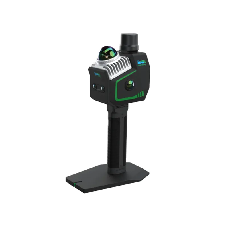
<3 cm accuracy • 1.3 kg • 360° LiDAR • 70 m range • 200k pts/s • 4 cameras • 512 GB SSD • IP64.
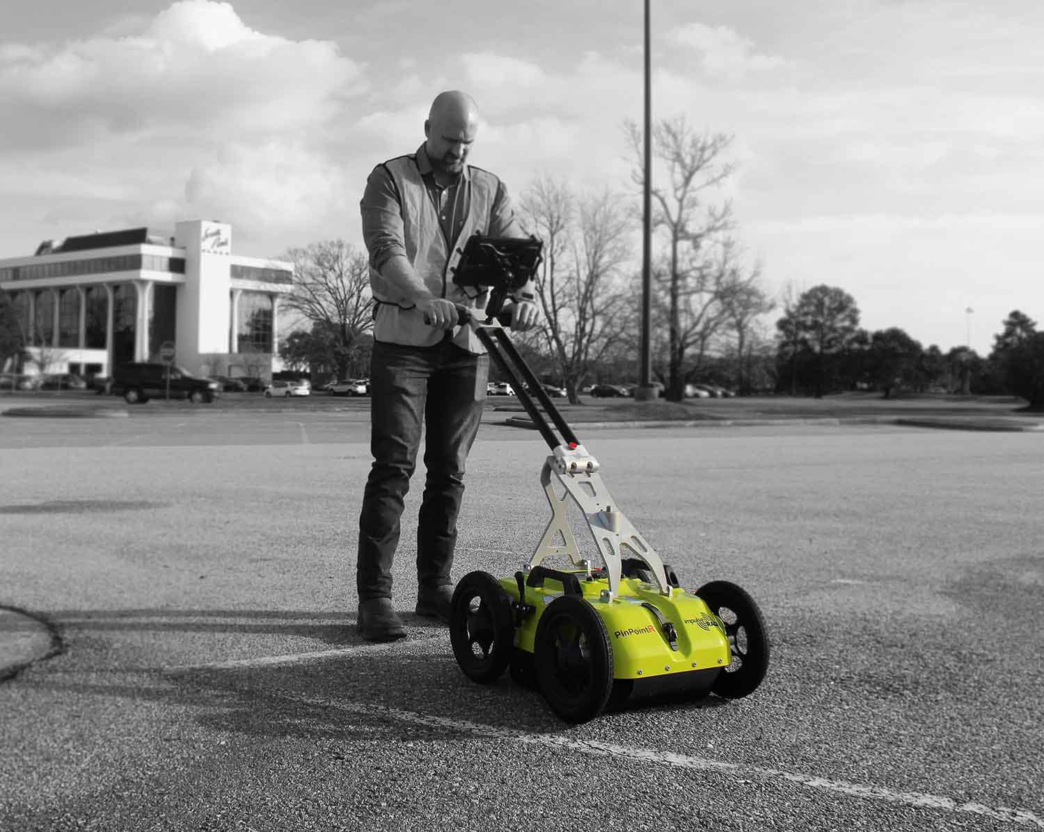
Dual‑channel GPR • 400/800 MHz • RTS real‑time sampling • >800 scans/sec • 130 km/h • IP65 • CE/FCC/IC approved.
High‑speed 3D GPR array • RTS technology • 450 MHz & 800 MHz • >130 km/h @ 5 cm interval • IP65 rugged.
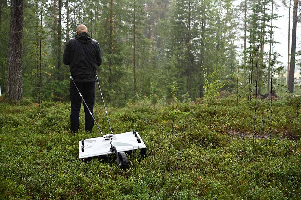
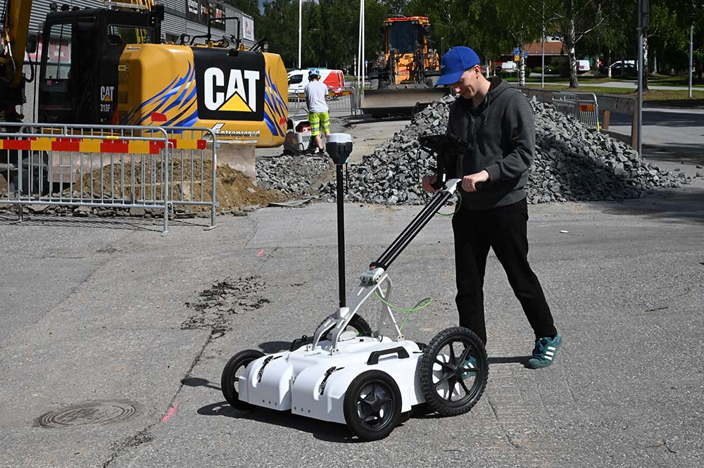
General‑purpose dual‑channel GPR • RTS • 70/300–400/800 MHz dual‑freq antennas • Android control • IP65 rugged.
1590 channels • Multi‑constellation • 15 km UHF • 120° tilt • 20+ hrs • IP67.
Laser + dual camera • 1668 channels • Auto‑IMU 120° • 15 km SNLonglink • OLED display.
Android 12 • 5.5″ FHD • QWERTY • 9000 mAh • 4G/Wi‑Fi/BT/NFC • IP67.
8″ sunlight‑readable • Android 12 (GMS) • Integrated GNSS • 4G/Wi‑Fi/BT 5.1 • IP67.
8″ sunlight‑readable • Android 12 (GMS) • Optional high‑precision GNSS • 4G/Wi‑Fi/BT 5.1 • IP67.
6″ sunlight‑readable • Android 11 (GMS) • SinoGNSS K8 • RTK‑cm/PPP‑dm • 4G/Wi‑Fi/BT 5.0 • IP67.
6″ sunlight‑readable HD • Android 11 (GMS) • 4G/Wi‑Fi/BT 5.0 • IP67 • 1.2 m drop.
In‑cab rugged tablet • Built‑in pro GNSS • QUANTUM™ III • 8″/10.1″ Android • 4G/Wi‑Fi/BT 5.0 • Cameras.
Medium-range LiDAR • 1.3 kg • 750 m range • 550 kHz scan • ±5 cm accuracy • 26 MP camera • IP64 • DJI compatible.
Medium-to-long-range LiDAR • 2.25 kg • up to 1000 m range • ±5 cm vertical accuracy • 100–2000 kHz scan • 26 MP camera • GNSS/IMU • Wi-Fi.
<3 cm accuracy • 1.3 kg • 360° LiDAR • 70 m range • 200k pts/s • 4 cameras • 512 GB SSD • IP64.
Dual‑channel GPR • 400/800 MHz • RTS real‑time sampling • >800 scans/sec • 130 km/h survey speed • Internal DGPS + external GPS support • Android UI • 7 hr battery • IP65 • CE/FCC/IC approved.
High‑speed 3D GPR array • Real‑Time Sampling (RTS) technology • 450 MHz & 800 MHz antenna options • Survey speeds >130 km/h @ 5 cm interval • Multi‑channel modular array • Vehicle or cart mount • 60 cm scan width • IP65 rugged.
General‑purpose dual‑channel GPR • real‑time sampling (RTS) • available in 70/300, 170/600 & 400/800 MHz dual‑frequency antennas • integrated GPS • Android control • wireless data link • >800 scans/sec • IP65 rugged.
Coming Soon
Our Total Station product range is being updated. Check back soon!
Coming Soon
Our Auto Level product range is being updated. Check back soon!
Coming Soon
Our Hydrography product range is being updated. Check back soon!