Our Products
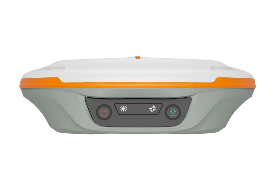
N2 Palm GNSS Receiver
- 1590 channels; 50+ satellites
- GPS, BDS-2/3, GLONASS, Galileo, QZSS, IRNSS, SBAS
- UHF up to 15 km • Tilt 120° (≈2.5 cm)
- 20+ hrs • 10,000 mAh • IP67
Jupiter Laser RTK
- Laser + dual camera stakeout
- 1668 channels • all constellations
- Auto‑IMU tilt 120° • OLED status
- Super datalink up to 15 km
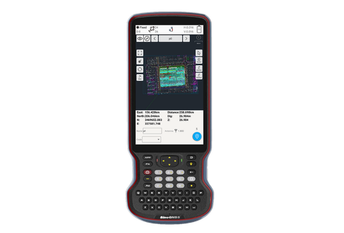
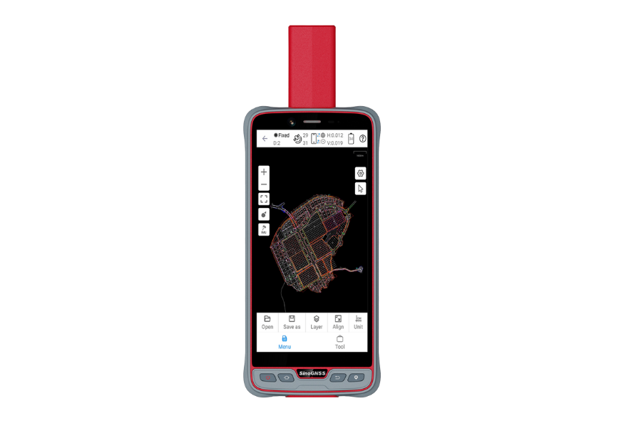
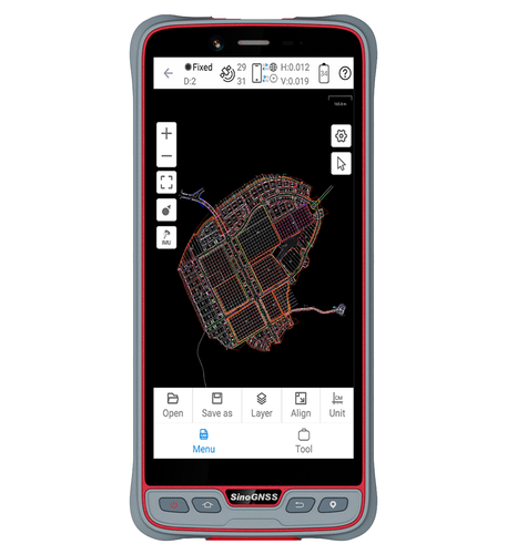
R60 Android Data Collector
- Android 12 • Qualcomm 8‑core
- 5.5″ FHD sunlight‑readable
- 9000 mAh • fast charging
- 4G • Wi‑Fi • BT • NFC • IP67
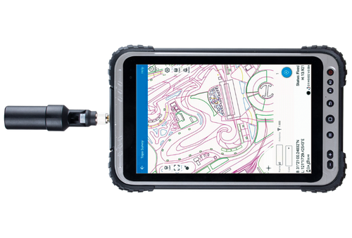
P8H Handheld
- 8″ sunlight‑readable
- Android 12 (GMS)
- Integrated GNSS module & antenna
- 4G LTE • Wi‑Fi • BT 5.1 • IP67
P8 Handheld
- 8″ sunlight‑readable
- Android 12 (GMS)
- Optional high‑precision GNSS
- 4G LTE • Wi‑Fi • BT 5.1 • IP67
P6H Handheld
- 6″ sunlight‑readable
- Android 11 (GMS)
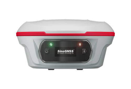
- SinoGNSS K8 board & antenna
- RTK‑cm / PPP‑dm • 4G • Wi‑Fi • BT 5.0 • IP67
P6 Handheld
- 6″ sunlight‑readable HD
- Android 11 (GMS)
- 4G • Wi‑Fi • BT 5.0
- IP67 • 1.2 m drop
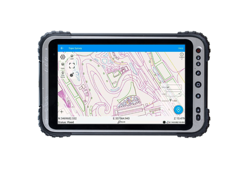
P300 GNSS Tablet
- Built‑in pro GNSS • full constellations
- QUANTUM™ III enhanced heading
- 8″ / 10.1″ HD touchscreen • Android
- 4G LTE • Wi‑Fi • BT 5.0 • Cameras
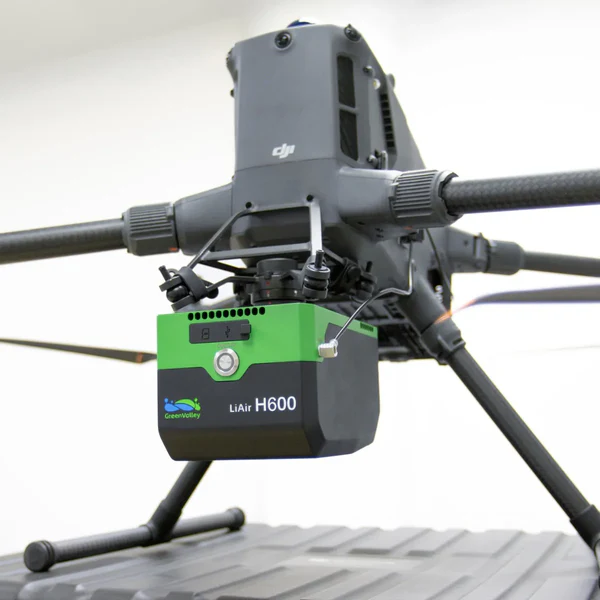
LiAir H600
Medium-range LiDAR • 1.3 kg • 750 m range • 550 kHz scan • ±5 cm accuracy • 26 MP camera • IP64 • DJI compatible
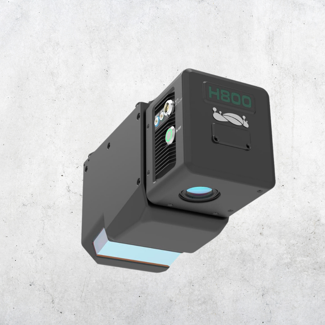
LiAir H800
Medium-to-long-range LiDAR • 2.25 kg • up to 1000 m range • ±5 cm vertical accuracy • 100–2000 kHz scan • 26 MP camera • GNSS/IMU • Wi-Fi.
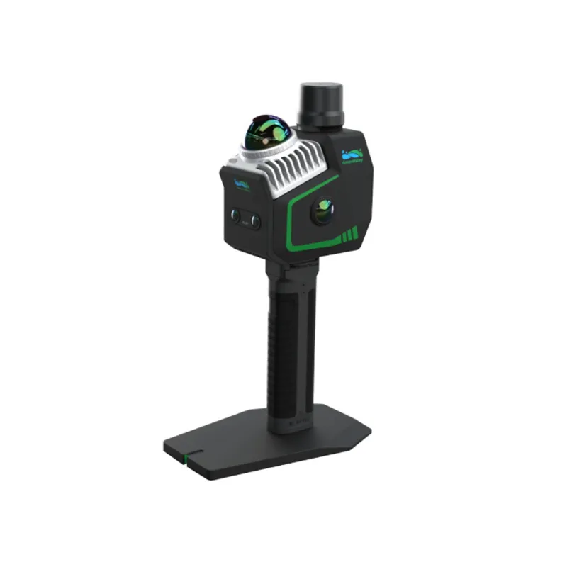
LiGrip O2 Lite
<3 cm accuracy • 1.3 kg • 360° LiDAR • 70 m range • 200k pts/s • 4 cameras • 512 GB SSD • IP64.
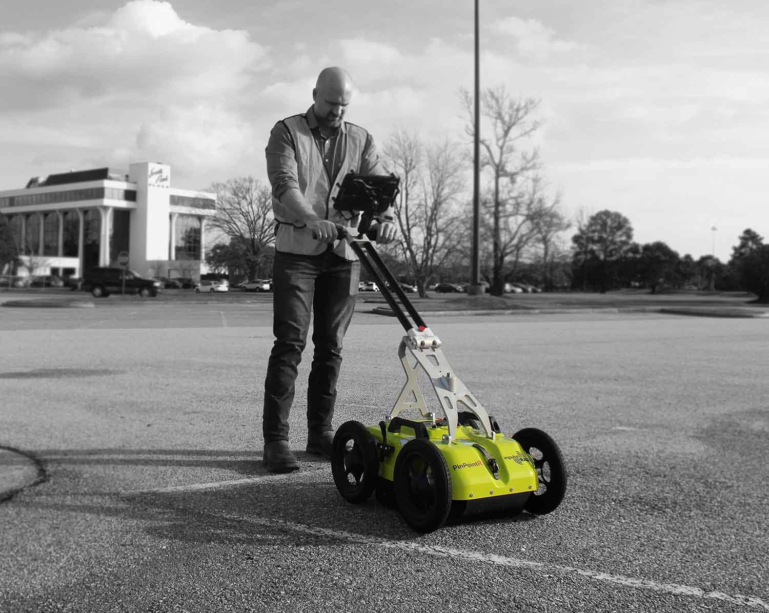
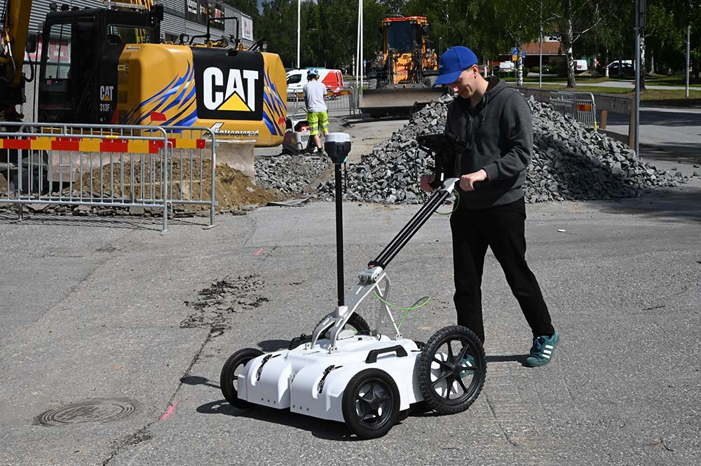
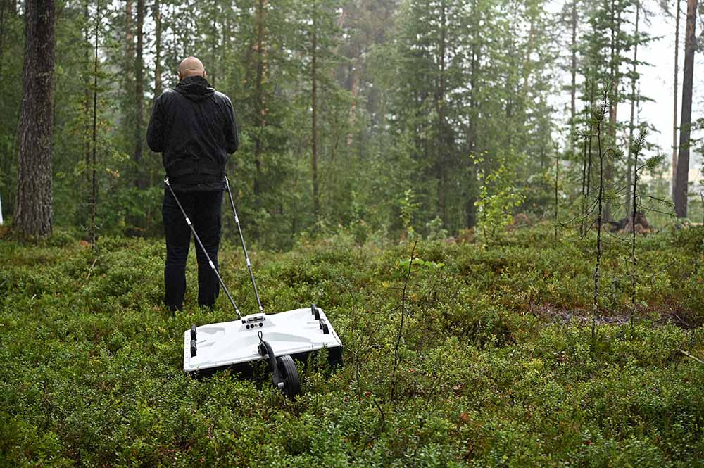
PinPointR GPR Utility Locator
Dual‑channel GPR • 400/800 MHz • RTS real‑time sampling • >800 scans/sec • 130 km/h survey speed • Internal DGPS + external GPS support • Android UI • 7 hr battery • IP65 • 6.35 kg (antenna) • Cart system ~20 kg • CE/FCC/IC approved
Raptor 3D GPR Array
High‑speed 3D GPR array • Real‑Time Sampling (RTS) technology • 450 MHz & 800 MHz antenna options • Survey speeds >130 km/h @ 5 cm interval • Multi‑channel modular array • Vehicle or cart mount • 60 cm scan width • IP65 rugged • Condor/Talon software support • ideal for utility mapping, infrastructure, archaeology, road/bridge inspection.
CrossOver Series GPR
General‑purpose dual‑channel GPR • real‑time sampling (RTS) • available in 70/300, 170/600 & 400/800 MHz dual‑frequency antennas • integrated GPS • Android control • wireless data link • >800 scans/sec • >130 km/h survey speed • 7 hr battery • IP65 rugged • access carts & pulling kits • ideal for infrastructure, geological, archaeology, environmental & utility surveys.
N2 Palm GNSS Receiver
1590 channels • Multi‑constellation • 15 km UHF • 120° tilt • 20+ hrs • IP67.
Jupiter Laser RTK
Laser + dual camera • 1668 channels • Auto‑IMU 120° • 15 km SNLonglink • OLED display.
R60 Android Data Collector
Android 12 • 5.5″ FHD • QWERTY • 9000 mAh • 4G/Wi‑Fi/BT/NFC • IP67.
P8H Handheld
8″ sunlight‑readable • Android 12 (GMS) • Integrated GNSS • 4G/Wi‑Fi/BT 5.1 • IP67.
P8 Handheld
8″ sunlight‑readable • Android 12 (GMS) • Optional high‑precision GNSS • 4G/Wi‑Fi/BT 5.1 • IP67.
P6H Handheld
6″ sunlight‑readable • Android 11 (GMS) • SinoGNSS K8 • RTK‑cm/PPP‑dm • 4G/Wi‑Fi/BT 5.0 • IP67.
P6 Handheld
6″ sunlight‑readable HD • Android 11 (GMS) • 4G/Wi‑Fi/BT 5.0 • IP67 • 1.2 m drop.
P300 GNSS Tablet
In‑cab rugged tablet • Built‑in pro GNSS • QUANTUM™ III • 8″/10.1″ Android • 4G/Wi‑Fi/BT 5.0 • Cameras.
LiAir H600
Medium-range LiDAR • 1.3 kg • 750 m range • 550 kHz scan • ±5 cm accuracy • 26 MP camera • IP64 • DJI compatible
LiAir H800
Medium-to-long-range LiDAR • 2.25 kg • up to 1000 m range • ±5 cm vertical accuracy • 100–2000 kHz scan • 26 MP camera • GNSS/IMU • Wi-Fi.
LiGrip O2 Lite
<3 cm accuracy • 1.3 kg • 360° LiDAR • 70 m range • 200k pts/s • 4 cameras • 512 GB SSD • IP64.
PinPointR GPR Utility Locator
Dual‑channel GPR • 400/800 MHz • RTS real‑time sampling • >800 scans/sec • 130 km/h survey speed • Internal DGPS + external GPS support • Android UI • 7 hr battery • IP65 • 6.35 kg (antenna) • Cart system ~20 kg • CE/FCC/IC approved
Raptor 3D GPR Array
High‑speed 3D GPR array • Real‑Time Sampling (RTS) technology • 450 MHz & 800 MHz antenna options • Survey speeds >130 km/h @ 5 cm interval • Multi‑channel modular array • Vehicle or cart mount • 60 cm scan width • IP65 rugged • Condor/Talon software support • ideal for utility mapping, infrastructure, archaeology, road/bridge inspection.
CrossOver Series GPR
General‑purpose dual‑channel GPR • real‑time sampling (RTS) • available in 70/300, 170/600 & 400/800 MHz dual‑frequency antennas • integrated GPS • Android control • wireless data link • >800 scans/sec • >130 km/h survey speed • 7 hr battery • IP65 rugged • access carts & pulling kits • ideal for infrastructure, geological, archaeology, environmental & utility surveys.